We’re cycling back on some things that we all think we know, and we think you all think you know, but you know, the new guys might not know, so who’s to know?
In that vein of redundancy, here’s your reminder for the day (and my link fodder for the support teams):
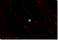
This little gem is the geomarker. California decided we all needed to know where the coordinate system was, so they added this new blip in 2009. Since we’re all used to the idea of working in the real world, it’s just an annoyance to most users, and can be turned off by typing GEOMARKERVISIBILITY and setting the value to 0. Set this in your template for more happiness.


I wish this was an Autodesk global variable. It was quite annoying to do this every time I opened up a drawing until I added it to the s:startup! 🙂
Rick
Who do you speak of when you say “California”? I am in California and part of http://www.c3usa.org and we didn’t ask for it. Or are you talking about San Rafael?
Of course I’m referring to Autodesk’s San Rafael office.
And it’s time to update that wishlist, it’s 2008.